
Paint every street of your city.
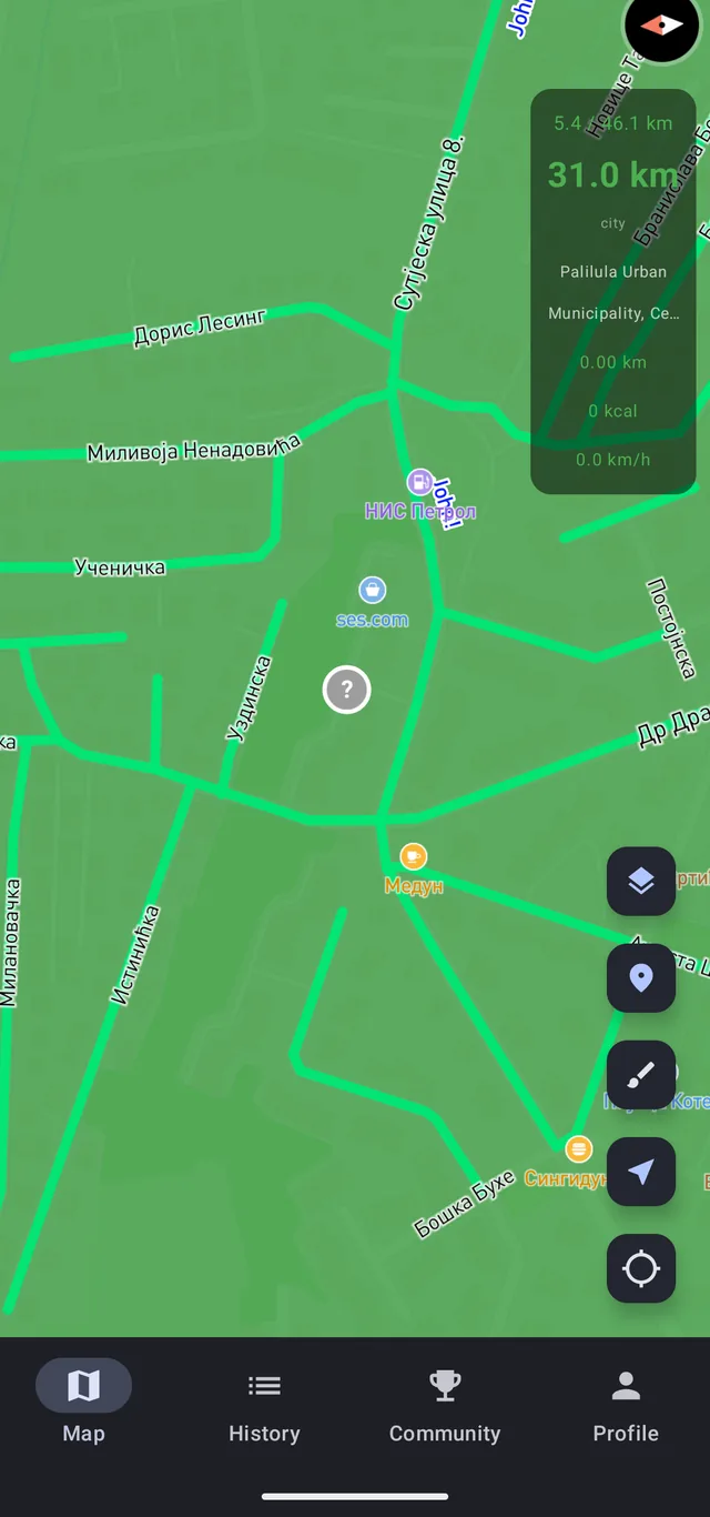
Start a walk and StreetPainter matches your GPS trace against the real street network. Every road you walked lights up on the map and stays lit.

- Free no ads
- Works with the screen off
- Streets from OpenStreetMap
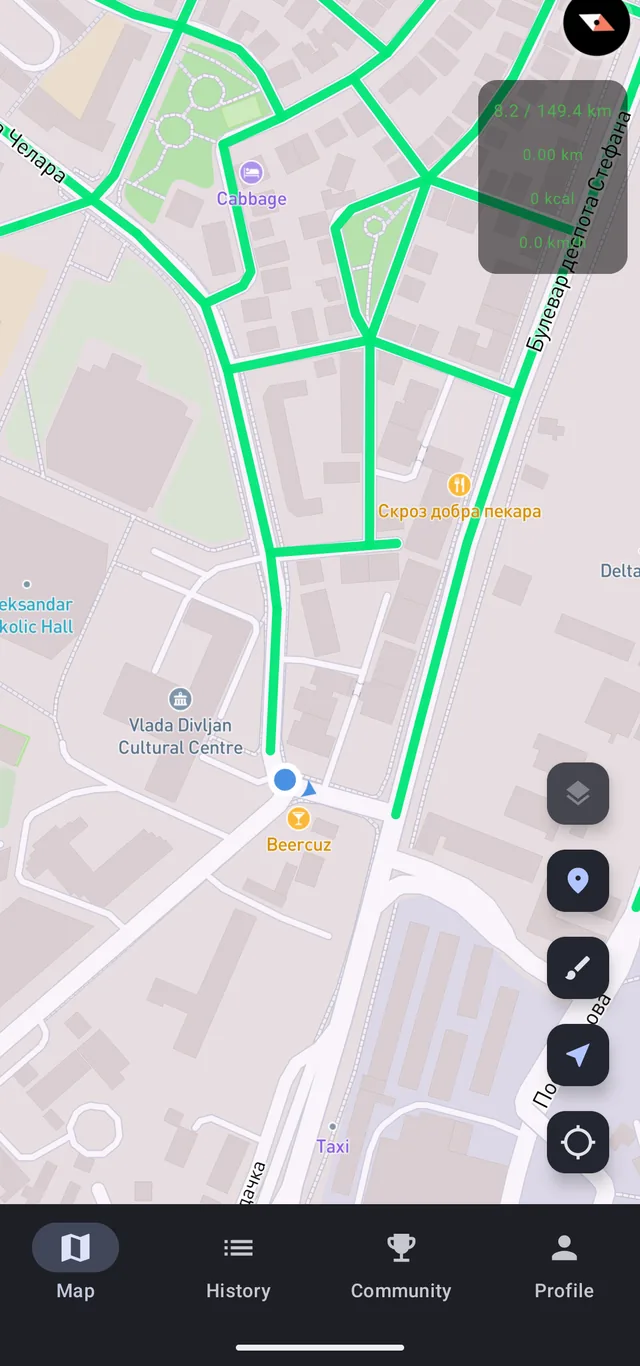
Every walk leaves a mark on the map.
And it stays there.
No route to follow and no workout to log. The map remembers everywhere you have been, and shows you, block by block, everywhere you have not.
Three steps to a painted city
You tap start when you head out and stop when you get back. The app does the rest by itself.
Start a walk
One tap. Tracking keeps running in the background with the screen off, so the phone can stay in your pocket the whole way.
Streets paint in
Your trace is matched against the real road network, so the map paints the streets you walked along, not a straight line between two GPS points.
Your map fills up
City, region and country each keep their own kilometre count. Close the gaps and a blank map turns into your map.
A walk that hooks you
See how it went
Every walk in your history has a replay: it plays back, and the route paints across the map just like it did that day. If it came out pretty, share it: a looping GIF or a stats card goes to your story in one tap.
- A replay right on the map, with pause and watch again
- A GIF of the route painting itself
- A stats card: story, square or 4:5
City, region and country
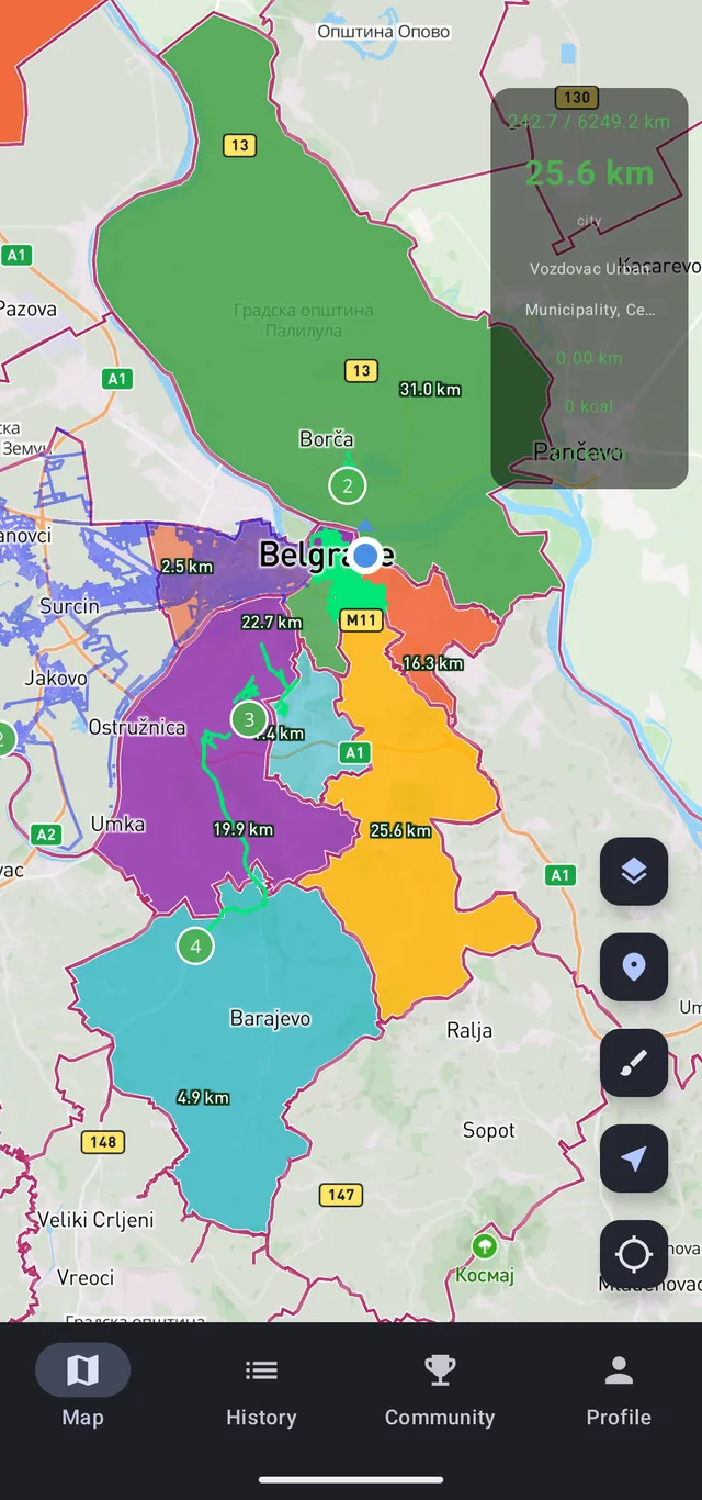
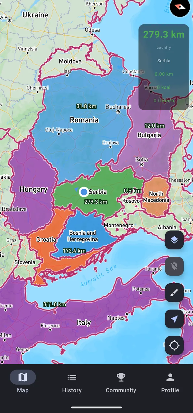
You walk your own neighbourhood, and the kilometres count towards the city, the region and the country at the same time. Zoom out far enough and you are looking at a whole country painted by your own walks.
- A kilometre counter that climbs while you walk
- City, region and country counted separately
- A big city splits into districts and zones
The spot you have walked past for years
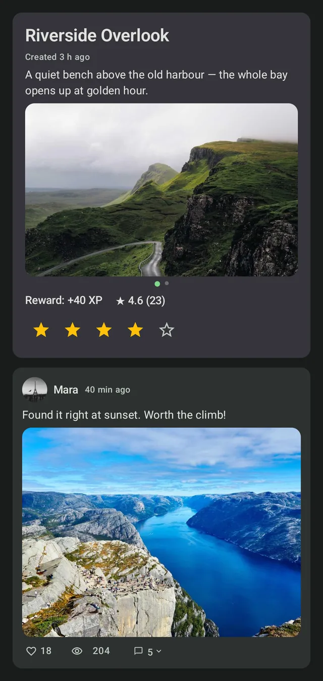
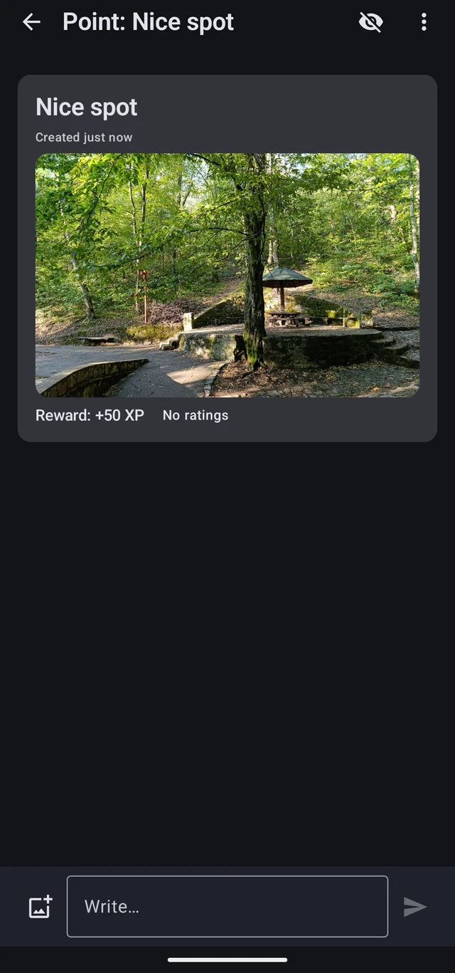
Find something worth stopping for and drop a point right on the map: photos, a couple of lines of description, and other walkers will see it. Someone else's point opens once you get within 150 m of it.
- Your own points with photos and a description
- Ratings and comments
- Locked pins hint at what is nearby
A reason to take the long way home
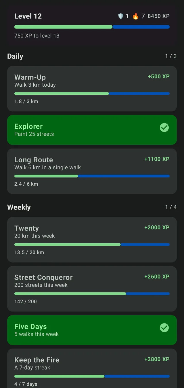
New goals turn up every day and every week: walk the kilometres, open new streets, do not skip a day. The longer the streak, the bigger the reward at the end of a walk.
- Daily and weekly quests
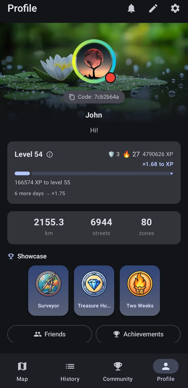
- Streaks, XP rewards and new levels
- 94 achievements, 53 of them secret until you trip over them
Other people walked here too
Add friends, share routes and compete. The map shows you where a friend has already walked and where they have not got to yet.
- Friends' routes layered onto your map
- Global and friends leaderboards, by kilometres, zones, XP or level
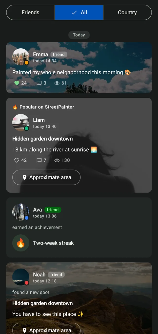
- A feed of points, walks and photos from other walkers
Stats and charts
Distance, streets, duration and XP charted over any period you pick, plus personal records and elevation gain. Steps and calories are estimated from distance.
Make it yours
Route colours, avatar frames and a route pulse open up as you level. Profile, post and comment backgrounds come from the community, uploaded and voted on by other walkers.
Your own walking screen
You pick which numbers ride along during a walk: kilometres, pace, new streets, streak. The set is yours to arrange with premium, and the kilometres and the streak are there for everyone.
On foot, by bike or in the car
Pick the mode in the settings and the app moves its speed limit to match. A drive paints the same streets a walk does.
What it looks like
Community
Talk to people who get it
Swap routes, compare maps and see what other walkers are painting. Bug reports and feature requests get read there first.
Join the DiscordQuestions about tracking, battery and privacy
What is StreetPainter?
An Android app that paints the streets you walk onto your own map. During a walk it records your GPS trace, matches it against the real OpenStreetMap street network and fills in the segments you covered, while the kilometres count up by city, region and country. On top of that sit discovery points, quests, levels, friends and leaderboards.
How does it paint streets?
StreetPainter records your GPS path during a walk and matches it against the real street network, filling in each segment you actually covered. A road you only passed nearby stays dark.
Is it free?
Yes, and there are no ads. Painting streets, coverage, discovery points, quests, friends, leaderboards and sharing your walks all cost nothing. Premium adds the unwalked-roads highlight with a jump to the nearest one, history and stats past the last five days, replays of walks older than yesterday's, a friend's territory on your map, your own set of numbers on the walking screen, and cosmetics you can equip. A new account gets all of it free for five days.
Does it drain my battery?
It does while a walk is running. GPS works from start to finish and never switches on between walks. Allow background location and exclude StreetPainter from battery optimisation, or Android can kill the recording halfway through.
Can I use it while cycling or driving?
Yes. Pick walking, cycling or car in the settings and the app moves its speed limit to match that mode. The streets paint in the same way they do on a walk.
Is this like Fog of World or CityStrides?
Somewhere between them. Like Fog of World it opens up a map as you move. Like CityStrides it tracks street-level completion. Plus quests, levels and discovery points.
What platforms is it on?
Android only, through Google Play. There is no iPhone version yet.
Who can see the routes I walk?
Friends only, until you say otherwise. Route visibility starts at friends and can go to everyone or to nobody. When you attach a walk to a post, the app trims 100 m off each end by default, so the line does not start at your front door.